



IntelliPaper
Abstract
Biostratigraphic artifact evidence sealing the Hannibal invasion route, combines classical historical and geological-biostratigraphical facts supporting the long-contested southern route over the highest pass--Col de la Traversette (~3000 m). The evidence for the southern route is patently expressed by Polybius in his Histories. Opposition to the northern route, originally championed by Sir Gavin de Beer some 70 years ago, earmarked the southern-Col de la Traversette-pathway as the only entrance to Italia, with a matching rockfall on the lee side. Thus de Beer's southern route in the face of his new classical history is supported by inexorable geomorphic and biostratigraphic findings.
Explore Digital Article Text
Introduction
The Hannibalic Army invasion route across the Alps, originally reconstructed by Polybius and re-published over two millennia by several authors and editors has undergone changes and corruptions (de Beer, 1967), so that present-day editions give only the essentials of what was originally published by Polybius’ in his native Greek. At present, the three main routes shown in Fig. 1—Northern route (Napoleon, Hart, Lazenby), Southern route (de Beer), and the mid N-S route-(Connolly)--bring to bear the main protagonists of these various routes, although there are other minor versions from the Col de Larch, Provence Alpes Côte d’Azur in the deep south of the Western Alps to Switzerland in the far north. Variations of de Beer’s southern route also include de Luc (1818), Tilley (1888), Torr (1925), and Prevas (1998). Polybius, cast as probably the first stratigrapher in history (Mahaney, 2023a), or at least one of the first scientists of the ancient world, spent time logging notes at a rockfall site that had blocked Hannibal’s retreat from the Alps through the upper Po River Valley. Anyone else, would have mentioned the rubble, paying little or no attention to the source of the rock whereas Polybius noted it was a two-stage system, one mass clearly distinguished from the other by age. By extension, this time division would have required paying attention to rock tonal contrasts, weathering age, possibly soil stratigraphy (Mahaney et al., 2022), and most certainly lichen diameters (Beschel, 1950, 1957) and cover (Mahaney, 1987; Julig et al., 2013). Recent research by Mahaney et al. (2022), using weathering, soil stratigraphy, lichen cover, and comet airburst data reinforced Polybius’ early assessment of the rockfall (Mahaney, 2023a), now firmly embedded in classical history as one of the lynchpins of the 218 BC Hannibalic invasion, perhaps its most relevant geomorphic feature.
Major routes proposed for the Hannibal Invasion showing the positions of tribal areas skirted by the army south of Drôme River, past Gap to the Guil/Durance confluence and the Guil River-Traversette—boundary in white for the southern proposed route. From Mahaney et al., 2017a. Credit: JPL, USGS.
Using Penguin’s translation of Polybius (trans. Scott-Kilvert, 1979) brings the essentials of the march, recounted to Polybius through his interviews with Hannibal’s veterans some fifty years after the invasion, starkly focused on main crossings, marching distances, Orange (France) encounter, river confluences, tribal encounters, olive-branch friendship offerings, defile battle, approach group refit, and most important a large landslide (rockfall) blockade on lee alpine slopes, and a refitting area on the lee side. Somehow, and for no logical reason, these key signposts of the Hannibalic invasion have been ignored or reconstituted to send Hannibal’s army all over the Western Alps, even into Switzerland, viz. Terrell (1922) and Dodge (1891), the Suisse version taught at the United States Military Academy West Point, (USMA), no less. Confusion over stream names which gave rise to interpretations of the Arar with the Isère brought editors and translators at some point to seek a northern invasion track, thus avoiding all other signposts that pointed East not North. One of the biggest errors arose over the triangle shape of the fertile area near Orange in present-day France. It was not enough to avoid using Polybius’ marching distances. The true shape of three rivers turning Orange into the ‘island’ had to await de Beer (1967) pointing to the Aygues matched against the Rhône, not the Isère matched against the Rhône, as some (Proctor, 1971) have asserted. Others familiar with the Hannibal literature of the 19th Century, Napoleon among them (de Montholon, 1905) targeted Mt. Cenis (main northern proposed route) as the most likely crossing point. And for those proposing a northern route (Freshfield, 1886, 1899; Lamb, 1958; Hart, 1967; Proctor, 1971; Walbank, 1990; Lazenby, 1998; Lancel, 1999), as well as the S-N loop (Connolly, 1981, Fig. 1), they must account for Hannibal’s marching time from Orange north to the Drôme/Rhône confluence and how this fits into the shape of the Alps, a crescent with a high ridge that leads to a river crosssing. The high ridge can only mean the Col de Grîmone (44o 41' 29” N; 5o 39' 14”E (1318 m asl) and/or the nearby Col de Cabre (1193 m asl), both thoroughly researched by Mahaney (2008), the Grîmone fitting the topography outlined by Polybius (III, 50).
Leaving the Rhône and first pass where Hannibal ascended the Alps (de Beer, 1967), the narrative of the route is supported by Livy (Trans de Sélincourt, 1972) asserting (XXI, 31.9) that Hannibal intercepted the lands of the Tricastini, skirting the boundaries of the Vocontii and Tricorii (Fig. 1) without serious encounters. These data are all the more important as they are supported by fragments of surviving literature from Timagenes of Alexandria recorded by Ammianus Marcellinus (XV, 10. 11) and Strabo (trans. Jones, 1999, IV. 1.11) in his location of Gaulish tribes. Silius Italicus (trans. J.D. Duff, 1934, Punicus, III, 442-476) marks the fringe of Hannibal’s march as intersecting the southern boundary of these three tribal groups. Interestingly these tribal boundaries have moved little in two millennia, forming first the boundaries of Roman civitas and later the Catholic Dioceses (mapped from Etienne Clouzot’s work, p. 21, de Beer, 1967). Livy supports the southern route, documenting Allobroges advances to Hannibal, as they shadowed his troops on the ascent, using the herald of olive branches that do not grow in the Isère Valley. The forthcoming river crosssing is documented by both Polybius and Livy as difficult in early fall, which must mean the Durance, as documented by de Beer’s river flow records that show Durance flooding is linked to springs, not snow melt as occurs with the Isère (charts in de Beer, 1967, Figs 1-3, pp 73-75). Adding to the southern route, Appian, trans. White (2002), a 2nd Century AD Greek historian who wrote extensively on Roman History, says little about the invasion but documents ‘Hannibal’s Pass’ as the route into the peninsula (Cisalpine Gaul), thus supporting other Greek and Roman sources. In modern times Seibert (1993) favored the Traversette but provided little confirming evidence outside of elevation and the one pass above timberline (Schwörer et al., 2014). Of all the passes, the Traversette comes out as an orphan, its steep decent into the Po Valley outlined by Polybius as extremely dangerous, seemed enough to send others on north no matter how much the mileage factor had to be distorted.
Linking these various key points to test the northern route, investigators shoving Hannibal way north, must not have contended with the Vercors, the rugged terrain around Grenoble where Hannibal would have had to fight his way through the Allobroges (Fig. 1), to gain access to either Mt. Cenis or the Col du Clapier entrances to the Dora Riparia, not the Po Plains documented by Polybius. Moreover, corrupting the marching mileage specifically documented by Polybius, an ex-general in the Macedonian Army and an authority fully acquainted with military speed during his lifetime, makes one wonder how far editors such as Terrell (1922) and Dodge (1891) would go to further the marching distance through Switzerland. This assumes Hannibal could get through homeground occupied by the Allobroges, a fierce Gallic tribe so well known, that even today there are hundreds of streets and avenues in France carrying their tribal name. Surely adding two weeks to the fifteen-day mountain transit alloted to Hannibal by Brown et al. (1963) would likely mean Hannibal’s army would have mutinied or starved, not emerging on the Po R. Plains as specified by Polybius (III, 56). Polybius laid out the signposts to travel the invasion route and these have been strengthened by Sir Gavin de Beer’s polymathic grasp of classical history together with geographic/geomorphologic aspects of stream locations and a plea for assistance from natural history disciplines (de Beer, 1956, 1967, 1969, 1974). He, with his four volumes on the subject, stressed the need for some assistance from climate experts (i.e. Neumann, 1992) in particular, not expecting it might also come from a combination of geomorphic, geologic, pedogenic and microbiologic disciplines, the combination of geomorphic and biostratigrapic elements at the forefront of future endeavors explained by Mahaney et al. (2007, 2008, 2014, 2017a, 2017b, and 2018, 2019).
Methodology
The source of Polybius’ Histories, used here the English translation by Ian Scott-Kilvert, entitled the Rise of the Roman Empire, introduction by Frank W. Walbank, was published by Penguin Classics (1979). Despite Scott-Kilvert’s translations of several Greek treatises, including A Historical Commentary on Polybius, three volumes 1957, 1967 and 1979 and other works, he does not say what version of the Histories he read to produce his translation but given the present title, Rise of the Roman Empire, it must have been a title two hundred or more years following its original Greek printing in the 2nd Century BC, or sometime after the start of Empire, 27 BC, possibly later in the first century AD.
Assuming all major documentation by Polybius survived the transit of history, it is safe to say after reading Scott-Kilvert’s translation of the Hannibal invasion, that he gives every indication that Hannibal marched north of Orange to the Drôme/Rhône confluence (Fig. 1), concluding he turned east following Hannibal's marching distances according to his own translation of Polybius. He leaves out the problem Hannibal would have had marching deep into Allobroges territory, not to mention the topography of the Vercors, and far north of tribal areas that he is refuted to have skirted, all verified by ancient authors. There is no northern matching description in Polybius’ Histories (Mahaney, 2008) that meets this northern (corrupted) requirement. Later, after sacking a Gallic town—most probably a predecessor of La Batie de Montsaléon---near Gap, Hannibal entered the Durance Basin and was faced with a difficult crossing in early fall (Livy, XXI, 31). As de Beer (1967) points out the Druentia cited by Livy (XXI, 32) must be the Durance, not the Isère since only the former has high fall discharge from springs, while the latter has only spring flood from melting snow and ice. From this, the battle in the Combe de Queyras, the only such defile in the approach areas (Mahaney et al., 2010a), and refitting area in the upper Guil Valley (Mahaney, 2008), are the only areas that follow Polybius’ description. And the unexpected landslide (rockfall), blockade on the lee side of the Col de la Traversette (Tricart et al., 2003), as documented by Polybius (Mahaney, 2008, 2023a), suggests Polybius knew exactly where he was going when he left Cartagena in Spain. Authors (i.e., Hunt, 2018; MacDonald, 2015) and editors over the centuries who have followed a false edition or corruption of Polybius have nothing to substantiate a northern route, much less one into Switzerland.
Results
3.1 Polybius-Background
Caught up in the Macedonian-Rome conflicts of the 2nd Century BC, coming out on the losing side, Polybius, a cavalry general, was ordered to Rome as insurance against any further military conflict. Essentially he was under house arrest, where he came under the influence and protection of Scipio Aemilianus, son of Scipio Africanus of Zama (202 BC) fame. It was Scipio who managed to unleash the Senate’s hold over Polybius, allowing him access to the immense library of the Scipio household and eventual release for him to accompany Scipio on his far-ranging travels to Carthage during the third war, and to the middle east where he made predictions of the silting up of the Sea of Azov and the Black Sea (Şengör, 2020 and pers. comm., 2023). Amassing documentation and sources for his forthcoming Histories, Polybius at some point, determinedly decided to focus on Hannibal and his exploits pivotal to understanding the Second Punic War (219-202 BC), all this as he put his history of the Roman Republic together. What survives of his Histories comes in the form of several books beginning with the 129th Olympiad (264-260 BC), precisely where Timaeus’ philosophy of the world ends, and Roman aggression outward into Sicily begins, bringing conflict to Carthaginian settlements.
At some indeterminate time, possibly at the end of the Third War (149-146 BC) Polybius interviewed veterans of the Hannibalic Wars, especially those who had been with the original invasion force, to determine the route which he intended to follow taking notes for his major work. Either he had translators, or he spoke Carthaginan (Aramaic), or possibly his interviewed veterans spoke Latin, but at any rate he was able to gain the trust of former soldiers who plumbed the depths of their memories to recount the invasion route in some detail. Given Senatorial restrictions on his movements, it is likely he was accompanied by Scipio or by some of his officers, as he traced the route from Cartagena along the Iberian Coast to the Pyrénées, across southern Gaul to the Rhône, crossing near Arles and beyond, some ~40 km, to Orange and the fertile ‘island’ at the triangular shape of the Rhône and Aygues confluence. Assuming marching distances left to us by Polybius have not been corrupted over the centuries by editors and translators who have interacted with the main Greek text, it seems that Polybius followed instructions given to him by Hannibal’s veterans. Even considering the time lapse and memory erosion affecting veteran oral testimony, and possibly their shifting allegiances between Carthage and Rome, it seems Polybius came away with a rough map of the invasion route. Whatever Polybius gained from Hannibal's veterans, these testimonies took him to the Drôme/Rhône confluence, then east to the first battle near the Col de Grîmone, thence to Batie Montsaleone, and Gap with Allobroges followers along the way, to the Durance crossing. To brush local tibes—Tricastini, Vocontii, Tricorii---as recounted by Livy, Silius Italicus, Timagenes and Strabo, and as shown in Fig. 1, he would have had to follow the Drôme route to avoid the Col de Montgenèvre, the narrow pass [1850 m asl; Massif, Queyras (Alpes); 44° 55′ 51″ nord, 6° 43′ 24″ est] swarming with Allobroges, and cross over the Durance to the Guil R. entrance. This, then would put him at the entrance to the Combe de Queyras, a 19-km long narrow defile with steep walls, steeper on the west, leading on to a giant rock buttress, known today as the Chateau Queyras (fortress in the 18th-19th centuries, a museum today). It may be the giant rock Polybius mentions although the descriptions in his text (Polybius, III, 53) refer to a giant rock nearer the entrance to the Combe, so the giant boulder within 2-km of the entrance near La Maison du Roy (Mahaney, 2008) might be the great rock thus described. It is within the Combe itself that Polybius gives a riveting picture of what Hannibal faced: marauding Gauls, presumably Allobroges, clamouring behind his rearguard (commanded by Hannibal) and other Gallic forces bombarding his troops (mainly Punic mercenaries) in his mid column with all manner of Permian through Late Jurassic sedimentaries and schist. With his cavalry and elephant corps safely ahead, Hannibal took refuge by a giant rock, his forces separated by a well-planned but poorly executed enfilade attack by the Allobroges (Mahaney and Tricart, 2008). As determined by Mahaney et al. (2010a, 2010b) the only certified defile matching Polybius’ fixated description is the Combe de Queyras leading inland along the Guil River toward the Chateau Queyras from near Guillestre Town Centre.
3.2 Sir Gavin de Beer
First, a review is needed of how Sir Gavin de Beer became involved in the search for the elusive Hannibal route, as best it can be reconstructed 50-70 years from his time. As recounted by Sir Gavin, he was invited to the offices of Professor Spenser Wilkinson of Oxford, to discuss among other things, the problem of the Hannibal route that had confounded so many. Could de Beer turn his attention to the route problem, and give it a dose of classical history and geography, to perhaps lend some authority to the issue. Starting with Professor Wilkinson’s (1911) book on Hannibal, de Beer examined all aspects of the route, filling in details from Polybius’ Histories, visiting field sites (de Beer, 1974, Fig. p. 180), adding new information from ancient authorities including Strabo, Timagenes and Silius Italicus, to mention just a few. He then relied heavily on Cecil Torr (1925) and his work but deviated from his approach along the Durance from the Rhône Delta north to where it joined the Durance/Guil confluence. Taking Torr's end point at the Guil/Durance confluence as given, De Beer (1967) disgarded his proposed swing through the Rhône Delta to the Durance, which would have exposed the Punic right flank to Roman forces in Massilia (Marseilles), and forfeited Hannibal's march north to meet his proposed refit with friendly Gauls near Orange (Polybius III, 49). And as summarized by Mahaney (2008, p. 183) 'Assessing the topography of the lower Rhône, Hannibal was faced with two choices: give battle to the Romans who were marching up from Massilia or follow his grand strategy by marching up the Rhône to the "island" where he could resupply his army and prepare to enter the Alps.' Following Hart's (1967) assessment, Hannibal almost always followed his strategy.
De Beer then put his knowledge of linquistics as it applied to river names such as Druentia, Arar and Skar to effect, eventually digging out the forgotten Aygues catchment, matching it with the Rhône making the perfect triangle that Polybius mentioned in his work. Next he relied on Livy for mention of the tribes Hannibal encountered—Tricastini, Vocontii, Tricorii—showing their territory matched perfectly with Roman civitas, later the dioceses of the Roman Church which prevailed until the present. Professor de Beer described the Hannibal problem as an ‘itch’ that perturbed him from time-to-time, his remedy emerging over nearly three decades in the form of four books, starting in 1956, ending after his death in 1972. His first early books—1956, 1967---summarized all the evidence, his methodology requiring experimental fact, similar to his earlier methods researching embryology of which his two books (one with Sir Julian Huxley) upset a rather staid, if not totally quiet medical discipline. He had a Darwinian mindset requiring explicit fact finding by experimentation, not idiosyncratic modeling, and in fact he wrote a book on Darwin (de Beer, 1962) that brings this methodology up front.
As a military man in WWI (Lt. Grenadier Guards) and WW2 (Intelligence-SIS) Sir Gavin was well acquainted with tactical vs. strategy modes as a serving Colonel in the last war, and both military streams come forward in his analysis of the Hannibalic Army route across the Alps. He may not have been so comfortable with Polybius leaving us with so few signposts along the route, nor with his emphasis and notes on the rockfall, later documented by Mahaney (2023a), but he did tear apart all of the mileage records in Polybius’ Histories. As for the mileage, all the kilometrage from the Pyrénées to Arles and from Arles to the rockfall, and out to the Po River Plains check out with no discrepancies, verified by Mahaney (2008). Aside from the mileage and timing, his location of tribal areas from Hannibal’s time to today, tied to Polybius and other authorities of ancient times, show Hannibal could only have marched to the south of the Drôme River, across Gap, past the Col de Génévre to the Durance. As Livy and others point out, the olive branch sign of friendship from the Allobroges shadowing Hannibal, puts a cap on any attempt to corrupt Polybius’ data with a northern route either to Mt. Cenis or Col du Clapier, much less Switzerland. The olive tree grows only south of the Drôme River. The Vercors itself, near Grenoble, would have meant no wagons, incredible tough terrain, all swarming with Allobroges not allowing passage, one impossible pathway.
Discussion
One environmental parameter that separates the southern route from all others in the Western Alps is the timberline (Tessier et al., 1993) because Polybius is definite about the passage through an alpine zone, that is, above forest which today and yesterday precludes all passes except the Traversette (Polybius, III, 54). Add to this the climate reconstruction of Neumann (1992) that showed the Hannibal climate matched the climate of the late 20th Century; if correct, this verifies the Polybius assertion of the Traversette being largely forest free, substantiated by Bagnall (1999). The forest itself is variable through time as human occupance since the last ice age has affected it greatly (Walsh et al., 2007; Mahaney et al., 2008) and de Beer quotes Virgil (Trans., Savage, 1934) speaking of pine forest surrounding Mt. Viso; alas, with no time frame or elevation mentioned. While the only timberline reconstruction for the area is based on ecological factors (Tinner and Theurillat, 2002), for the Central Swiss Alps, their reconstruction shows mid-Holocene (~2200 yr) variable forest limits well below ~3000 m asl.
The rockfall intervenes here since Livy documents the use of fire to combust boulders to high temperature, tossing sour wine to contract rock, thus to rubble. In contrast, Polybius (III, 54, 55) is mute on the subject, making it highly unlikely such an event took place. And sour wine was precious, its use to cure mange on horses widespread in ancient times. Despite satirical comment through time, Swift (1735) summed it up in his discourse as highly improbable and the need for wood (Bagnall, 1999) to produce combustion a major concern. Considering the physical state of Hannibal's army at this juncture in his exfiltration of the mountains, it is doubtful his troops had the energy to haul wood any distance to fire the rockfall. Considering energy expenditures of Hannibal's soldiers (Bagnall, 1999), humans and animals were close to starvation mode at this point in the trek to the lower reaches of the Po River, hardly capable of fetching wood for anything other than levers to remove boulders from the rockfall, in the three days allotted for this by Polybius (III, 55).
The final proof for the existence of the fertile crescent (Orange), provided by de Beer (1967) traced a triangle moved up-and-down the Rhône as far as the Isère, settling on the Aygues/Rhône confluence, the only location, near Orange, matching the marching distance from Arles as stated by Polybius. Confusion over river names was put to rest in the same piece by de Beer who unraveled various interpretations and river name changes over time that added to a deconstruction of attempts by others to make sense of Arar and Skaras, translated through time to Aygues. By any standard de Beer (1956, 1967, 1971, 1974) brought classical history links with modern military strategy and tactics, and geography together to prove, on factual evidence, that Hannibal’s route was to the south of all other discussed routes through northern France and Suisse. His plea for assistance from natural history came in a most metaphoric way with a cross of disciplines---geomorphology, weathering, pedology, biostratigraphy and microbiology---to produce the only landform (Traversette) that could be the rockfall, among all the rockfalls on the lee side of the Alps, so convincingly studied by Polybius (verified by Mahaney, 2023a). His attention to deposit modifications, source of the landslide (later translated to rockfall by Mahaney (2008), and later reconfirmed by Professor Pierre Tricart, University of Grenoble, personal conversation to WCM, 2008), and most likely lichen/soil covers marks him out as one of the earliest stratigraphers in the history of human thought. Next, entails biostratigraphy, the core of which is built upon microbiological evidence so astutely brought to the fore by Professor Chris Allen and his associate Dr. Jonnie Young focused on species of Firmacuties and Clostridia bacteria known to have familiarity with horse and mule dung (Young et al., 2018). Arguing, that, if Hannibal went through specific areas (landforms) the thousands of animals in tow would have built excessive populations of Firmacuties and Clostridia (i.e. the Mass Animal Deposition (MAD beds) that could be detected through layers of sediment cored at specific sites (Mahaney et al., 2017a, b). Age controls on higher concentrations of these bacteria are in cores (location, Fig. 2; stratigraphy Fig. 3). The full story follows as annotations of Polybius’ evidence, and if polymath Sir Gavin de Beer were alive and could review the evidence today, I believe his exclamation might be: ‘I told you so’.
4.1 Biostratigraphic Evidence
The biostratigraphic evidence emerged from a chance meeting with Kris Hart, chemistry graduate student from the City University of Dublin, presenting a paper at an American Geophysical Union conference in Toronto (2007). His methodology touched on a long problem about the extremely slow decompostion of organic matter in paleosols dating from the Olduvai subchron of the Early Pleistocene glaciation on Mt. Kenya (Mahaney et al., 2013). Kris showed the redox potential and uptake of amorphous Fe were chief factors in slowing or stopping conversion of organics to C/N cycles. What arose from this collaboration eventually included Professor Chris Allen (Queens Belfast), microbiologist and his team including Professor Brian Kelleher (Dublin City University) who took a keen interest in the Hannibal enigma and joined in, first in 2011, and every two-year stint thereafter. In the meantime the project has continued to move along (Mahaney et al., 2019) and published in the journal Archaeometry.
Demonstration of the bacterial record comes from several cores and records from the French alluvial mire record, one of the G5 sites (Fig. 2) previously published in Archaeometry (Mahaney et al., 2017a,b). Pulling three cores in 2011, there was no idea what would come out beyond AMSC14 ages of sediment horizons, perhaps some key beds that would tell something about sediment/landscape change, perhaps also within several layers (beds), what effect might be found (Fig. 3). This core in a Histosol (organic soil) depth was near 1 meter in depth and color variations that Hannibal’s troops and handlers might have produced on the land cover. Studying these three cores (Fig. 2) from 2011 on, produced initial results that between the 30-50 cm depth it proved possible to measure sediment upheaval, and while reliable bracketing ages were nearly impossible to measure, the beds were definitely disturbed and housed reworked organic sediment. Soon after came the realization that unreliable ages were the result of older, reworked organic sediment mixed with animal faeces. Later in 2013, the team regrouped and pulled the G5B core adjacent to sites shown in Fig. 2, and the results studied in greater detail in Fig. 3 showed thin beds of alluvium (light) against organic (dark) sediment, the latter punctuated to designate brief times with sedimentation low, and soil formation aggressive for a short, undesignated time. All five cores taken at the G5 site produced similar stratigraphies, alluvial sedimentation punctuated by short-lived attempts to produce soil. The top 25 cm in Fig. 3 is fibrist, with near 80% organic matter, staggered water content highest at surface, and density lowest, the latter increasing with depth. Pacing percent organic matter with bulk density and water content is relatively synchronous with depth. Crossing the fibrist/hemist contact, staggered organic matter percent rises with water content and decreases in bulk density, with the bulk invasion effect noted as the Mass Animal Deformation (MAD) area reflecting high but variable organic content, again in synch with water and bulk density.
Early sites (G5 group) in the French alluvial mire. The three cores recovered from these sites established that deformed beds could be located and dated but exact ages for the MAD beds would be difficult. From Mahaney et al., 2017a.
Assessing age controls where thousands upon thousands of troops, horses and elephants trod on the land surface which is mixed with reworked organic sediment brought in by foot and hoof, one lone AMSC14 age of 2070 ±31 cal yr BP marks the first recovered organic material following the invasion at a depth ca. 43 cm where coincidentally the organic matter in the MAD bed shows a sharp downward increase shadowed by water increase and expected decrease in bulk density. The thin laminae below the 2070 ±31 date carries an AMSC14 age of 2530 ±90 which is positively reworked organic sediment imported to the section from older beds higher in the valley (Walsh et al., 2007). Thin beds with lost horizontality, mixed with animal/human faeces, and reworked organic sediment, are randomly populated with reworked sediment, dating from 2530 ±90 to 3537 ±28. One drawback in an environmental setting like this is the danger of organic contamination, which is already demonstrated by so much reworked material. On the plus side, however, all age standard deviations are low in the ±28-31yrs and matched by the one date 1130 ±30 at the fibrist/hemist boundary where normal sedimentation had been underway for centuries. The two ages with ±90 or 100 yrs probably relate to contamination with influxes of water carrying minor contaminants. Such situations crop up in many similar situations, as on Mt. Kenya (Mahaney, 1990), where similar fluctuating water in alluvial fans, sometimes produced even greater contamination with inverted bed C-14 ages. Another example comes from reworked pollen in coprolites (fossilized faeces) from Late Glacial Spain (Bronk Ramsay and Lee, 2013 and Carrion et al., 2001). Considering the Hannibal landscape destruction model painted here, reworked organic sediment is the norm, not the exception, which makes precise decadal dating of the event difficult resulting in close dating of the 2070 ±31 (UBA-24875) age.
Two standard deviations (1σ x2) places the upper limit of AMSC14 dating to 2132 yr BP, a maximum age but still close within the Hannibal window (Mahaney, 2008; Hannibal et al., 2019). With the minimum age at two standard deviations (95%), the 2070 ±31 (UBA-24875) is 2008 yr BP. Taking the 2070 (UBA-24875) age, at 68%, from 2244 yr (calculated against 2026 AD) it still took nearly a century for the degraded Hannibal landscape (at ~40-45 cm depth) to recover enough flora to produce carbon and yield a reasonable date. All AMS-C14 dates at levels younger than ~40 cm (see Mahaney et al., 2019) yield ages younger than 2070 ±31 (UBA-24875). AMS-C14 dates older than 2244 yr are reworked from soldiers and animals degrading and disrupting surface sediments dating into the Early Holocene (10,000 yrs), and most likely stretching across the entire upper Guil and Po valleys (Mahaney, 2008).
Core G5B, in the French alluvial mire, upper Guil River showing compatible changes in water and organic matter with depth, each variation offset by negative changes in bulk density. AMSC14 ages illustrate the range of preweathered material reworked into the site and the lone C-14 age of 2070 ±30 cal yr BP marks the renewal of normal horizontal sedimentation following the Hannibalic invasion. From Mahaney et al., 2017a.
In this case, however, with wholesale disturbance of the MAD beds and adjacent disrupted sediment, one can imagine the scale of landscape disturbance that occurred across the whole of the upper valleys of France and Italy in the fall of 218 BC. It would have been a flattened, reshaped landscape, nearly devoid of intact soil profiles, especially the surface Ah/B horizons (Mahaney et al., 2017a).
Further examples of micro-bed disruption, overturning, even micro-faulted bioturbated beds (Fig. 4) is common in all sections and retrieved cores at site G5 in France and the V21 group in the upper Po Valley (Mahaney et al., 2019). Here, beds younger than 1.8 ka maintain semi-horizontality conforming to disturbed/contorted beds below in the MAD group and within the MAD beds some AMSC14 reworked material dated to the Early Holocene. This suggests there are more sections in the upper Po carrying a full range of datable material beyond what was found earlier (Walsh et al., 2007; Mahaney et al., 2022). In all sampled sections and in recovered cores sampled from near surface to depths of 60 cm, the twin bacteria Firmacuties and Clostridia, low in most horizontal beds, spiked within the MAD group and adjacent beds, with common depths of 35-60 cm in all samples running up to 2017 (Young, 2018).
4.2 Hannibal Hypothesis
The rarity of merging geological and associated sciences with classical or near history is not a common endeavor (Mahaney, 2018). Despite this, proving corruption of Polybius’ Histories is one thing (de Beer, 1967), but righting various corrupted hypotheses of a northern route, present for nearly 2000 yr, is another, and no easy task as it continues today (MacDonald, 2015; Hunt, 2018, Hoyte, 1960). Belief structures are common enough to human thought but in scientific pursuits they can hold up disciplinary and even multi-disciplinary work by overlooking or corrupting the most logical hypothesis.
Surface section in an alluvial fan, V21A, in the upper Po Valley, Mon Viso. Dated surface beds show it takes centuries to restore horizontal sedimentation following massive surface land deformation.
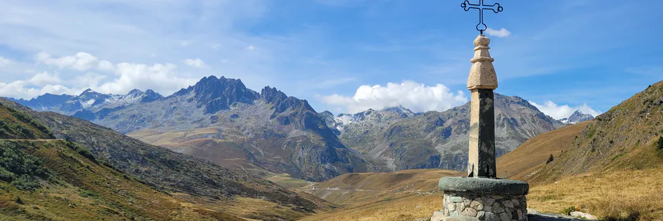
With Polybius and his seminal work, it seems corruption of his text (de Beer, 1967) comes mainly from elevation, judgements of cols, north to south in the Western Alps, that is, difficulty of transit and estimates of elevation. And this without any regard to Polybius’ statement (III, 55) ‘The crests of the Alps and the parts near the tops of the passes are completely treeless and bare of vegetation, because of the snow which lies there continually between winter and summer, but the slopes half-way down on the Italian side are both grassy and well-wooded, and are in general quite habitable.’ Polybius, a primary witness of the track followed by Hannibal, clearly describes a treeless alpine environment, with snow preserved during the seasons (firnpack), the Traversette (~3000 m asl) being the only pass meeting these requirements in Hannibal’s time and ours up to about 1990. Thereafter, firnpack only survives in a few protected north and northeast facing microclimates above 2800 m asl. (Mahaney et al., 2014), all other passes well below even this lower elevation.
Sorting through earth science hypotheses brings several examples of belief structures to mind, ones that lingered for centuries in some cases, hypotheses that required extraordinary proof to unseat. For example, the exemplary work of Şengör (2020) traced and rerighted 300 yr-old distortions of James Hutton’s ideas of sediment/rock age; Şengör, even mentioning (personal communication, 2022) Polybius’ transits in the Azov and Black Sea areas where he presciently predicted forthcoming silting up of both seas, an extraordinary claim (belief), likely ignored 2200 years ago. The struggle to prove plate tectonics started with Count Buffon’s Histoire Naturelle in the 18th Century, upgraded by Alfred Wegener and associates in the early 20th century, culminating with the proofs of Harry Hess, Maurice Ewing and Bruce Heezen in mid-20th century, which moved the hypothesis to settled theory. The Glacial hypothesis of the 19th Century, based on observations of Ignaz Venetz-Sitten and Jean de Charpentier, resulted in Agassiz’s book Études sur les glaciers (1840), which was initially nearly sunk with fierce disbelief and criticism of those who favored the deluge to Darwin’s iceberg drift theory. By 1860, Agassiz’s sceptics said they believed in the glacial theory all along. The YDAH (Younger Dryas Airburst Hypothesis) originating the Younger Dryas has undergone slow acceptance over the last two decades despite AMS C14 pinpoint dating, placing it decades ahead of the normal steep decline of Dryas octapetala (Mangerud, 2021; Mahaney, 2023b) that set off the last cold stage of the Pleistocene, ending 11.6 ka with the advent of the Holocene. With new sites coming on stream it is only a matter of time before the cause of the YD becomes settled scientific theory. And then there is the Hannibal hypothesis presumably starting with ‘stretches’ of Polybius’ mileage markers and misconstrued landscape features that shifted direction to northern cols, Mt. Cenis-Col du Clapier (Proctor, 1971; Hunt, 2018), even into Switzerland (Dodge, 1891).
Starting in 2002, it took several expeditions and all of eight years to investigate every col from the deep south of the Western Alps to the far north near Mt. Cenis (Fig. 1). Thus, concluding that the only rockfall capable of blockading Hannibal lay on the lee slopes below the Col de la Traversette, all others not able to block the passage of an army (Sodhi et al., 2006). The landforms plus minor pedological analysis in stream cuts and other sites that might have provided bivouacking potential to Hannibal’s troops were reinforced in places by sweeps with metal detectors (Mahaney et al., 2017c) that brought up any potential re-excavation of sites. In all this, the search continued for minor stratigraphic situations that could be explored further for weathering and pedological materials that might relate to dating by AMS C14 (Mahaney, 2004), the time frame of the Hannibal incursion. Also, incorporated into Hannibal’s Odyssey (Mahaney, 2008), once the Traversette Rockfall was confirmed, only the intial layout of sites demanding further exploration needed investigation, namely the alluvial mire (only one of its kind) on the French side and alluvial fans on the Italian side.
Reasoning that the Combe de Queyras battle would have exhausted Hannibal’s troops, it was only logical to imagine 2-3 days refitting the army in the upper Guil Valley would mean ~30,000 troops, spread across an area 2 x 3 km between 2600-2400 m asl, essentially the full upper valley. Likely sites of interest included water sources, especially the mire in the Traversette cirque and the southern distributary flowing out of Lake Lestio (Mahaney et al., 2022), into the main Guil River catchment. Continuing on with the blockade and clearing of bouldery rubble in the rockfall allowing passage reportedly took three days, the refitting infantry regrouping in the foraging meadows below in the vicinity of ~2000 m asl (present Pian del Re of the upper Po River). However, it was sectioning of surface deposits in the one alluvial mire that provided potential ballpark estimates of depth and configuration of the landscape left by Hannibal’s Army (Mahaney et al., 2017a, 2019), allowing for some estimation of landscape destruction from Hannibal’s army occupance of the landscape.
Equally, the Hannibal route enigma took two millennia to reach polymath Sir Gavin de Beer, and another seventy years to top my interest in classical history, stirring an ‘itch’ (de Beer 1956, 1967; Mahaney, 2008) to take all environmental information in Polybius and Livy and test it against modern-day databases. Like Polybius himself, my team field tested all information described above to conclude the southern route met all prerequisite tests required of the classical historical and biostratigraphical-geological sides. Thus, it is, a finality.
Conclusions
Thus, Hannibal’s Odyssey (Mahaney, 2008) combines geomorphic-biostratigraphic evidence with Polybius’ Histories and Sir Gavin de Beer’s classic-geographic analyses up to its publication date (1967). Introducing the Traversette Rockfall into the mix of evidence completes the diverse discipline approach to treating all the Western Alps pass possibilities for the invasion route. In all, this process slowly reduced some approaches/cols, favored others, until deciding that the closest reading of Polybius indicates the learned general and historian knew exactly where he was going from Cartagena, straight to the rockfall that his interviewed veterans likely remembered so well from so long ago. Polybius’ followers, including no end of editors, geographers, historians, and archaeologists over the last two millennia, have searched the northern catchments, interpreted (corrupted) the literature to prove the great captain crossed either Mt Cenis or the Col du Clapier, no matter the evidence against it. The facts compiled by Polybius, Sir Gavin de Beer and myself not only argue otherwise, but the rockfall itself, a one-of-a-kind landform on the lee of the Alps, certifies the route. The final support comes from biostratigraphic evidence, principally high concentrations of Firmacuties and Clostridia bacteria lying dormant over more than two millennia in Histosols (organic soils) of the alluvial mire on the west slope of the Traversette Cirque, horse facies the first artifacts of the invasion.
Polybius, the general and historian was also a man of immense curiosity, enough to tag him most probably the first stratigrapher (Mahaney, 2023a) in history. As a historian, he was not the first to attempt a universal history of the Mediterranean, but he was the first to attempt a description of imperialistic Rome conquering the whole basin in just over a century, from its first encounter with Carthage in 264 to its destruction in 146. Topping all this, he was probably the first to value practical experience, fact gathering and critical assessment of data, which is what probably prompted him to follow and log the Hannibalic invasion of Italia and its entry into the Second Punic War (two decades of Mediterranean War). He credited Rome’s success on its people, its Republican constitution in the early years, and chance. Rolling the dice, Polybius demonstrated how, with Hannibal, history might well have been rewritten, if only he had moved to confront Scipio's landing on Africa, he might have avoided Numidian (Masinissa) duplicity (Roman bribery) and won at Zama.
This translation by Ian Scott-Kilvert, like the Oxford translation by Robin Waterfield, includes the first five books of Polybius and fragments of Books 6 and 12. Book III contains the whole of the Hannibalic invasion and the Second Punic War. The geologic and biostratigraphic evidence cap, once and for all, the controversy over Hannibal’s route as outlined on the Science Website (Monahan, 2016). Hannibal took the Traversette, the highest and most difficult of all entrances into Italia, to avoid conflict with the Allobroges; hence the Traversette Col, named Hannibal’s Col thereafter, at least since Strabo (Late BC).
Research described herein was supported by grants to WCM from York University Minor Grants, and the National Geographic Society (NGS-2017). I am indebted to several colleagues who have discussed various collection procedures followed at dozens of sites in the Andes, European Alps, and Antarctica along with analytical methods used to process laboratory samples. As Leader of the Hannibal Project since its inception in 2002, I owe a debt of gratitude to Linda Mahaney for sharing my intense curiosity around the mystery of the invasion route and the various lines of inquiry pursued to solve it. In particular, I owe Volli Kalm (Tartu), David Krinsley (Oregon), Pierre Tricart (Grenoble), Peeter Somelar (Tartu) and Chris Allen and Jonnie Young (QUB) for assistance with field and lab endeavors over the last decade or so. One of the fortunate outcomes of the research was our association with Professor Pierre Tricart (geology University of Grenoble) who doggedly, year-after-year, argued on behalf of the research team to the Guil River Park authorities to allow continuance of field research in the upper Guil Valley. On the Po River side, research was limited to reconnaissance, until I managed (2015) to find Captain Marco Rastelli, the head of Mon Viso Park research on the Italian side; thereafter all further research resumed smoothly. Without the year-by-year determination of Professor Tricart and Ranger Captain Marco Rastelli to keep the research on track, I would never have brought the accumulation and analysis of samples to its fullest stand and this paper would never have seen the light of day.
I also acknowledge support from the staff of the CAF Rifugio du Viso (France), Rifugio Giacoletti, and Rifugio Albergo Pian del Re (Italia). Marco Rastelli, formerly Chief Ranger and now Director of Specific Projects, Mon Viso Park (Italy), directed excavations in areas where we would not affect endangered flora or fauna. I am also indebted to students who have participated in field collection and laboratory work. In particular, I owe considerable thanks to Peeter Somelar (Tartu, Estonia), who entered the Hannibal team in 2015, picking up where Volli Kalm, his professor at Tartu, had assumed a heavy administrative load as President of Tartu University, Estonia, and perforce had to drop out. I had dinner with Volli in Toronto in 2016, by chance our last discussion of the Hannibal enigma, almost one year before his death in 2017. Had Volli lived he would have enjoyed the publications that ensued thereafter especially confirming de Beer’s southern route, the one outlined in Polybius’ Histories, reconfirmed by Sir Gavin de Beer and later in Hannibal’s Odyssey and several papers published in Archaeometry over the last two decades.
Conflict of Interest
Ethical Approval
Not applicable
Data Availability
Funding
This work did not receive any external funding.
References
Cite this article
Related Research

Special Issue
Launch a focused special issue to highlight research, emerging trends, and expert insights in your academic field.